
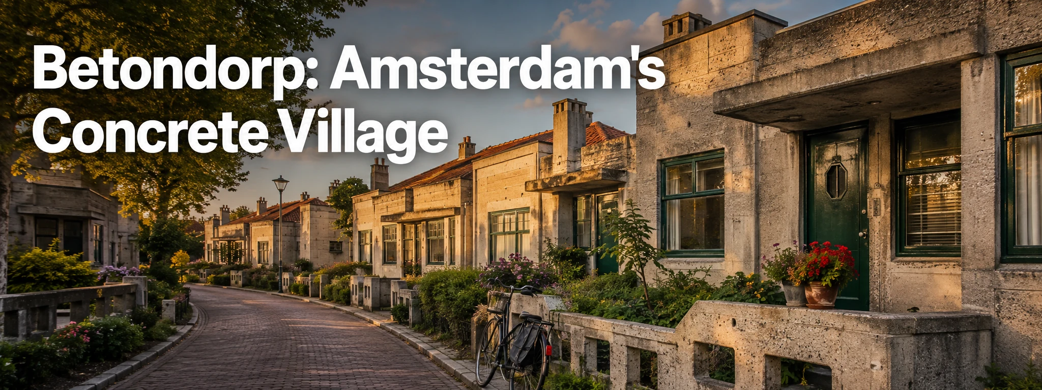
Betondorp is a good choice when you want to look at how Amsterdam housed ordinary people, rather than at another grand canal façade. I would choose it for a quiet architecture walk with time to notice street planning, corners and the relationship between homes and shared space. I would not put it ahead of the city's major museums on a first visit unless this kind of urban history is what interests you.
This is a lived-in neighbourhood in Watergraafsmeer, Amsterdam Oost. Its name means “concrete village”, but that does not mean every house is concrete or that the area is an open-air museum. The reward is in seeing the different parts of a planned neighbourhood together. Bring that expectation and the walk becomes much more interesting than a search for a single spectacular building.
What the concrete experiment was trying to do
The City of Amsterdam's heritage account places the project in the aftermath of the First World War, when shortages encouraged experiments with quicker, cheaper concrete construction. The concrete core was built largely in the mid-1920s, with later buildings around the Brink and traditionally built brick housing surrounding it. Different construction systems and architects were involved.
The same account records practical problems, including damp and cracking, and limited cost savings compared with brick construction. That makes the old summary “did it work?” too blunt. Construction economics, building performance and architectural quality are different questions. The neighbourhood can be historically important and visually rewarding without its original technical experiment having become the universal answer to housing.
I would keep those questions separate while walking. A housing project is not just a catalogue of façades: it also has to organise everyday movement and shared facilities. In Betondorp, that relationship between the street network, a central gathering place and the houses is a large part of what you have come to see.
Start with the Brink
Use the Brink as your orientation point. Before walking into side streets, take a moment to look at the square and how the surrounding buildings frame it. Notice entrances, corners, changes in height and the way pedestrian routes connect with the open space. These are things you can observe from public space without needing access to an interior.
The national heritage register for the Brink complex describes the flat roofs, projecting and recessed corners, block-like forms and prominent chimneys. Those details give you a useful looking exercise: follow the outline of a building rather than concentrating only on its surface material. A simple-looking wall can belong to a carefully composed group.
Do not assume a building is open to visitors because it appears in a heritage listing. The record explains significance; it is not an admission ticket or a current opening schedule. If a community building has an advertised public event, check that event's own conditions. Otherwise, treat the exterior as the visit and leave private entrances alone.
A short, flexible walking plan
My suggested visit is an orientation stop at the Brink, a few nearby streets, and a return to the square. Veeteeltstraat, Landbouwstraat and Oogststraat are useful names to identify on your map before setting out. Choose a small loop that fits your energy and the weather rather than treating this as a compulsory street-by-street trail.
In the concrete core, look for changes in geometry: a recessed doorway, a corner that steps forward, a roofline interrupted by a chimney. Then compare the surrounding traditionally built houses. The contrast makes the area more legible than the blanket claim that everything here is unlike the rest of Amsterdam. You are looking at several answers to the same practical problem of making a neighbourhood.
A focused walk might take around half an hour; I would allow longer if you like photography or architectural detail. That is a suggested pace, not a promise that every important feature can be covered thoroughly in twenty minutes. There is no need to rush through residential streets to hit a guide's arbitrary completion time.
The garden-village idea
Betondorp is also known as Tuindorp Watergraafsmeer. The city's heritage explanation relates its plan to the garden-city movement: a response to crowded urban living that gave new residential areas a more village-like character. The planning matters alongside the concrete. Spaces, routes and neighbourhood functions belong to the story as much as the construction method.
While walking, compare a quiet residential street with the central square. Think about what makes a place feel self-contained: the arrangement of houses, the scale of the public space and the routes between them. You do not need to decide whether the original ideals succeeded in every respect to see that the design was about daily life, not merely a striking exterior.
The historical record and today's streets serve different purposes. A period photograph can explain the original setting, while a current walk shows an inhabited place with ordinary changes and maintenance. Avoid treating every modern sign, parked bicycle or shopfront as an intrusion into a frozen architectural exhibit.
How to visit respectfully
Stay on public pavements and keep doorways clear. Do not enter a courtyard, climb a step or photograph through a window to get a better composition. A protected building can still be somebody's home. For photographs, wider street views and architectural details that do not expose private life are the more considerate choices.
Keep conversations and group photography unobtrusive. If several people are walking together, leave room for residents and other pedestrians. Check before stopping in a cycle route. A quiet neighbourhood visit is most rewarding when you allow ordinary life to continue around you rather than making the street perform for the camera.
Getting there without a misleading fixed time
Plan the trip from your actual starting point to the Brink or the street you want to visit. Use 9292 or GVB for current public-transport options and walking connections. The previous fixed “twenty to twenty-five minutes from the centre” estimate was not dependable: the centre is a large area, and waiting, transfers and the final walk all matter.
Check the return journey as well, particularly if you are combining the walk with another timed activity. Do not schedule an onward museum reservation using only the vehicle's travel time. If walking access or step-free transport matters, investigate the route's specific facilities before leaving; this guide is not a surveyed accessibility assessment.
Who should choose this outing?
I would recommend Betondorp to someone already interested in housing history, urban planning or the less monumental side of Amsterdam architecture. It is also a thoughtful addition to a longer stay when you have already seen the obvious central sights. For a traveller who wants a lively market, a large museum collection or a guaranteed café crawl, a different neighbourhood may fit better.
Combine it with our Watergraafsmeer guide if you want a wider eastern-city outing. Keep the combination modest and check any separate attraction's opening information. The point is to give yourself enough time to see how the neighbourhood fits together, not to turn a residential walk into a race across Amsterdam.
Cheers, Carpe Diem & Look Beyond the Canal Façades! 🍻⏳🏘️
TATS Man
Your cyborg observer of the streets that explain a city.